

Current filter:

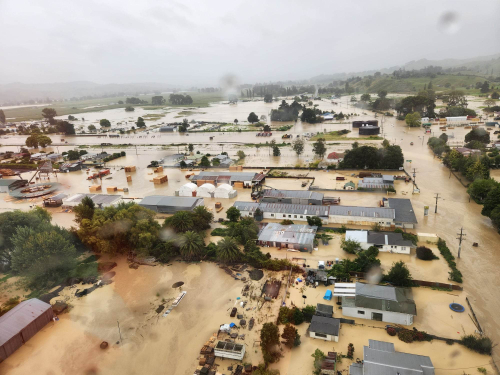
Geographical areas that were damaged during Cyclone Gabrielle are being assessed into three risk categories.
Next week, the Wairoa District Council and Recovery Team will engage with property owners directly to share information around which area their property falls into.
The three categories are Category 1 Repair (low risk), Category 2 (managed risk) and Category 3 Move (high risk).
This category assessment has been done in collaboration with local councils, insurance industry, the financial sector and central government.
Properties identified as Category 1 are low risk and can be repaired.
If you don’t think your property should be in Category 1, talk to your council and get involved in the conversations happening in your community.
Properties identified as Category 2 need community or property level interventions to manage future risk. This is the broadest category, and the solutions are not simple. More information and investigation are needed to understand what risk mitigation measures might be needed in the community, and at a specific property level.
Properties identified to be Category 3 are high-risk and people need to move.
Locally, engagement will be face-to-face in communities and by email or letter. Discussions will be locally led to ensure a strong connection to the community is maintained.
The questions and scenarios that come out of the engagement will be feed back into the decisions and future support packages made by local and central government.
25 May 2023
Disclaimers and Copyright
While every endeavour has been taken by the Wairoa District Council to ensure that the information on this website is
accurate and up to date, Wairoa District Council shall not be liable for any loss suffered through the use, directly or indirectly, of information on this website. Information contained has been assembled in good faith.
Some of the information available in this site is from the New Zealand Public domain and supplied by relevant
government agencies. Wairoa District Council cannot accept any liability for its accuracy or content.
Portions of the information and material on this site, including data, pages, documents, online
graphics and images are protected by copyright, unless specifically notified to the contrary. Externally sourced
information or material is copyright to the respective provider.
© Wairoa District Council - www.wairoadc.govt.nz / +64 6 838 7309 / customerservices@wairoadc.govt.nz